The summit photo from day five shows me standing in weak sun, pack still on, squinting at no one in particular. The ridgeline is visible behind me. A slice of valley below. It looks like a good day.
It was a good day. But the photo doesn't contain what the day contained.
An hour before that photo, I was sitting on a boulder below the summit on the Tafjord loop, eating a handful of mixed nuts and second-guessing the line I had taken across the snowfield below. I had gone slightly wrong. Not dangerously wrong. Just wrong enough that I had spent twenty minutes crossing loose scree that had no business being on my route. The GPS showed me exactly where I was. It didn't fix what I had already walked.
That conversation, the one you have with yourself when you realize you made an error and have to decide whether it matters, doesn't appear in the summit photo. It was the most interesting part of the day.
The data from the Tafjord loop is accurate. Eight days. 126 km. Around 7,400 metres of elevation. All of it backed up as GPX files, logged by the Garmin Instinct 2S Solar.
What those files hold: coordinates, timestamps, altitude readings, heart rate in some sections.
What they do not hold: the temperature of the stream water on day three, cold enough that it ached slightly to swallow. The quality of the light at 05:30 on day five, which I still think about. The twenty-minute stop beside a small lake in Tafjordfjella that I took because I wanted to stop, not because I needed to. The way the Silva Strive 26L finally settled correctly on day four when I repacked it, after three days of getting it marginally wrong.
The file has the route. The route had more than the file.
There is a gap between what gets recorded and what actually happened, and it does not close with better technology. A GPS track at 1-second intervals still won't tell you that you sat down at km 22, not because your legs were tired but because you stopped thinking about the next waypoint for a moment and noticed the light was doing something you hadn't seen before. The data gets more granular. The gap stays.
A photo documents where you arrived. A route traces how you got there.
That is the distinction I keep returning to, and it is why I built the poster tool. Not because the posters look good on a wall, though they do. Because a route printed at scale is a different kind of record from a summit photo.
A summit photo says: I was here.
A route poster says: I went from there to here, and this is the line I took, and this is how far it was.
The line is the record. The effort encoded in the line is the record. Not the view from the top.
The word I keep coming back to is evidence. Not proof, which has a courtroom feeling. Evidence. Something that shows what happened without requiring you to explain it.
The difference between a souvenir and evidence is this: a souvenir is about where you went. Evidence is about what you did.
I have a mug from Åndalsnes that I bought at a café after coming off Romsdalsegga. It has a mountain drawing on it. It is a souvenir. It marks a destination.
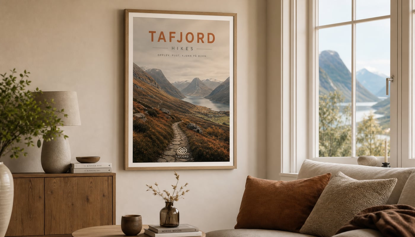
The Romsdalsegga poster on my wall is something different. It shows the 10 km of exposed ridge from Åndalsnes across to Veblungsnes. The route lines are visible. Someone who has done Romsdalsegga would look at it and recognize it. Someone who hasn't would see immediately that it was not a casual afternoon.
One of them requires me to explain what it represents. The other doesn't.
That is the difference I wanted to preserve when I designed the tool. The poster should do the explaining. You shouldn't have to stand next to it.
I am not certain the poster tool always solves the problem I think it solves. That uncertainty is worth saying directly. The honest question is whether people want evidence of effort, or whether they want something that looks good on a wall and happens to be a map. I don't know that the answer is always the former, and I suspect the distinction matters more to me than to most buyers.
What I am confident of is the underlying idea, because of what I felt on day seven of the Tafjord loop.
The weather had turned. I was carrying a sleeping bag heavier than what I needed, a mistake I knew about before I left and made anyway. I was tired in the way you get tired after six consecutive days of moving: not one sore muscle but something more general and harder to name, spread through everything.
I was asking myself, seriously, why I was still doing this.
The answer wasn't complicated. I was there because I had said I would be there. Because I had started at one end and the other end was still ahead of me.
That is a different reason from wanting to see the views. I did want to see the views, and they were real. But the thing keeping me moving at km 102, in cold rain, had nothing to do with scenery. It had to do with the difference between saying you are going to finish something and actually finishing it.
That is what a route records. Not the destination. The staying with it.
This journal is about what the route produces in the person walking it. Not the destinations. Not training periodisation or optimised nutrition windows. What actually happens to a person who chooses to keep moving when stopping is the easier and more reasonable option.
I will write about specific places, because specificity is the only thing that keeps this honest. Tafjord. Romsdalsegga. The Sunnmøre Alps from Ålesund. Eventually, if things go as planned, the length of Norway from Nordkapp to Lindesnes, roughly 2,800 km through the inland mountains.
I will write about specific gear, because kit decisions on a multi-day have real consequences and the honest version of those decisions is more useful than the aspirational version.
I will probably be wrong about some of what I think. I will find that out by trying to say it clearly.
The poster tool exists because I wanted a record that was better than a GPS screenshot. This journal exists for the same reason. The walk produces something. This is where I put it.